A working town that became a hiking and fishing base
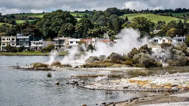
Tūrangi doesn’t look like a typical stop on a North Island itinerary. It was built in the 1960s to house workers on the Tongariro hydroelectric power scheme, and the grid layout and low, functional buildings still show that origin. What draws visitors today has nothing to do with the town’s architecture and everything to do with what surrounds it: the Tongariro River runs straight through it, Lake Taupō laps at its northern edge, and the volcanoes of Tongariro National Park rise a short drive to the south.
That geography makes Tūrangi the natural base for three things that don’t really overlap anywhere else in the region: serious trout fishing, the closest overnight stay to the Tongariro Alpine Crossing trailhead, and grade 2–3 whitewater rafting on a river most visitors only ever see from a bridge. None of the three require the others — you can come for just one — but plenty of people combine two on a single trip, since they’re all within a few minutes of the town centre.
Trout fishing capital of the south
Ask anglers in New Zealand where to fish for trout and the Tongariro River comes up constantly. It flows out of the mountains, through Tūrangi, and into the southern end of Lake Taupō, and that stretch has carried a reputation for large rainbow trout for generations. Fishing here isn’t a novelty activity built for tourists — it predates the town’s tourism economy and remains a working fishery with its own licensing and seasonal rules set by the local Fish & Game region.
If you’re new to it, that’s not a barrier: guided trips are common, and a guide handles gear, technique, and local knowledge of where fish are holding on a given day. If you’re experienced, Tūrangi is simply where you base yourself to be close to the water rather than commuting from Taupō town each morning. Either way, check current licence requirements and any seasonal closures before you fish — river conditions and rules can change from one year to the next, so this is one to confirm with a local guide or Fish & Game directly rather than from a guidebook. For the wider picture of where else around Rotorua and Taupō people fish, and how the fishery here compares, our trout fishing guide covers both waters together. One detail worth knowing before you order dinner anywhere in the country: trout is never sold in New Zealand restaurants or shops.
No commercial sale is permitted — a restaurant can only serve trout that a guest caught themselves, which is part of why the fishery is managed so carefully.
Gateway to the Tongariro Alpine Crossing
Of everywhere you could sleep the night before walking the Tongariro Alpine Crossing, Tūrangi is the closest. The crossing itself runs 19.4 km through Tongariro National Park, typically taking 6 to 8 hours, past active volcanic terrain in the shadow of Ngauruhoe and near Ruapehu — the same park that holds double World Heritage status for both its natural and cultural values. It is usually walked as a one-way track between two separate trailheads, which means almost everyone arranges a shuttle at one end.
Basing yourself in Tūrangi rather than Rotorua cuts a meaningful chunk off an already long day: the Mangatepopo trailhead sits well under an hour away, compared with roughly 2 h 20 from Rotorua. That difference matters on a track where an early start is genuinely useful — weather on exposed alpine terrain changes fast, and shuttle operators generally want walkers on the track well before mid-morning. For the logistics of doing the crossing specifically as a trip out of Rotorua, including whether staying overnight nearer the mountain makes more sense than a long day trip, see our dedicated Tongariro Alpine Crossing guide.
Track conditions and any closures are managed by the Department of Conservation and can change with weather, so confirm the current status before you commit to a date rather than assuming the track is open as described here. Outside the main walking season, the crossing becomes a genuine alpine undertaking requiring ice axes, crampons, and mountaineering experience — it is not simply a longer, colder version of the summer walk, and inexperienced parties have needed rescue after underestimating that difference. If winter mountains are more your interest than a long walk, Ruapehu’s ski season runs on the same massif, reached from the Tūrangi–Taupō side of the park.
Whitewater on the Tongariro River
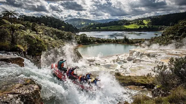
The same river that carries the trout also carries rafters. The commercially run stretch of the Tongariro sits at grade 2 to 3 — enough current and a few genuine rapids to make it feel like a real river trip, without the technical grade 5 water that some North Island rivers offer. That makes it a common choice for a first rafting trip, families with older children, or anyone who wants whitewater without the commitment of a harder river.
It’s worth being clear about which river is which, since the region has more than one rafting option and they’re not interchangeable. The Kaituna River near Rotorua is a shorter, steeper run built around Tutea Falls — at 7 metres, the highest commercially rafted waterfall drop in the world — and sits at a noticeably harder grade than the Tongariro. If you’re deciding which river actually suits your group, our guide to choosing a rafting river around Rotorua lays out the difference in grade, length, and what a day on each one actually looks like.
| River | Typical grade | What it’s known for |
|---|---|---|
| Tongariro (Tūrangi) | 2–3 | Longer float with steady rapids; approachable for first-timers |
| Kaituna (near Rotorua) | Higher grade | Tutea Falls, the world’s highest commercially rafted drop |
If a full self-drive itinerary around the volcanic plateau already includes a rafting stop near Rotorua, one option is to book that activity before you ever reach Tūrangi — for example a combined zipline and rafting day based out of Rotorua, which covers a different river but gives a useful comparison point for grade and pacing before deciding whether to add the Tongariro on top.
Beyond fishing, hiking, and rafting
Tūrangi’s location on Lake Taupō’s southern shore also puts it within reach of things usually associated with Taupō town itself. The Māori rock carvings at Mine Bay — figures around ten metres tall, carved into the cliff face in the late 1970s and visible only from the water — are reached by boat or kayak from points around the lake, and a trip can be arranged from the southern end as easily as from Taupō. A guided option like a kayaking tour out to the Mine Bay carvings combines the paddle with some background on how and why the carvings were made. For more on the carvings themselves and other ways to see them, our guide to the Lake Taupō rock carvings has the detail.
Further round the lake toward Taupō town, Huka Falls squeezes the Waikato River through a gorge only about 15 metres wide, and Craters of the Moon offers a geothermal walk on a smaller, quieter scale than the parks around Rotorua. Both sit close enough to Tūrangi to combine with a morning at the river or an afternoon before an Alpine Crossing shuttle pick-up. If you’d rather have someone else handle the driving and entry logistics for a loop that covers several of these in one day, a tour such as a full-day tour taking in Huka Falls and hot springs runs from the Rotorua–Taupō corridor and can be a practical way to see the falls without adding a separate stop to your own driving plan.
See our Huka Falls and Taupō jet boat guide for what’s actually on offer at the falls themselves.
Getting to and around Tūrangi
There’s no commercial airport or rail service into Tūrangi, so a private vehicle, rental car, or organised shuttle is the practical way in. From Rotorua, the drive runs south along the shore of Lake Rotorua and down through or past Taupō town before reaching Tūrangi at the lake’s southern tip — budget around 1 h 50 to 2 h without stops, longer if you break the journey at Huka Falls or in Taupō itself. New Zealand drives on the left, and if this is your first time driving in the country, our guide to driving in New Zealand for visitors covers the basics before you head out on unfamiliar roads, particularly relevant here given the winding, occasionally steep sections around the volcanic plateau.
Once you’re in Tūrangi, the town itself is small and walkable, but the things you’ve likely come for — the river, the trailheads, boat launches on the lake — are spread along the approach roads rather than clustered downtown, so having a car (or a pre-booked shuttle for the Alpine Crossing specifically) makes the visit far easier than relying on foot traffic alone.
Where Tūrangi fits in a wider trip
Because it sits roughly two hours from Rotorua and less than an hour from Taupō, Tūrangi works best as one stop within a longer loop of the volcanic plateau rather than a destination booked on its own from home. A multi-day drive such as our Rotorua–Taupō road trip itinerary can extend south to include a night in Tūrangi ahead of an Alpine Crossing start, while a tighter schedule might treat it as part of a single long day — our Rotorua to Taupō day trip itinerary gives a sense of how much of the corridor is realistic to cover without staying over.
| Trip style | How Tūrangi fits |
|---|---|
| Day trip from Rotorua | Rushed; only realistic if the sole goal is a guided rafting or fishing trip |
| Overnight from Rotorua | Comfortable base for an early Alpine Crossing start the next morning |
| Multi-day Taupō/volcanic plateau loop | Natural stop between Taupō town and Tongariro National Park |
For activities specifically inside the national park beyond the Alpine Crossing itself, our Tongariro National Park activities page rounds up the shorter walks and other options for those not attempting the full traverse.
Tūrangi: frequently asked questions
How far is Tūrangi from Rotorua?
By road it’s roughly 1 h 50 to 2 h, most of it along the eastern or western shore of Lake Taupō through Taupō town. There’s no direct rail or scheduled flight into Tūrangi; a car, shuttle, or organised tour covers the distance.
Is Tūrangi the same place as Taupō?
No. Taupō is the larger town on the northern shore of Lake Taupō, about 45 minutes north. Tūrangi is smaller, sits at the lake’s southern tip on the Tongariro River, and is oriented around fishing, hiking, and rafting rather than the lakefront tourism of Taupō town.
Can I do the Tongariro Alpine Crossing as a day trip from Rotorua?
It’s physically possible but long: the drive to the Mangatepopo trailhead is around 2 h 20 from Rotorua, and the crossing itself takes 6 to 8 hours one way between trailheads, plus a shuttle back to your car. Most people who don’t want to stay overnight in Tūrangi or Taupō join an organised day tour that handles the transport and shuttle logistics.
Do I need experience to raft the Tongariro River?
The commercially rafted stretch runs at grade 2 to 3, which is generally considered a suitable introduction to whitewater rafting and does not require prior experience. Operators provide safety briefings and equipment; specific trip conditions depend on river flow on the day, so confirm with the operator directly.
Is the Tongariro River good for trout fishing?
The Tongariro River is one of the country’s best-known trout fisheries, historically associated with large runs of rainbow trout moving up from Lake Taupō. Regulations, licences, and seasonal rules are set by the local Fish & Game region, so check current rules before you fish rather than assuming last year’s dates still apply.
Can I see the Tongariro Alpine Crossing without hiking it?
Not really. The crossing is a point-to-point track through the national park and there is no road or viewing platform that replaces walking it. Shorter walks near Tūrangi and around Tongariro National Park’s visitor areas give a taste of the landscape without the full 19.4 km traverse.
Is Tūrangi worth stopping in, or just passing through?
Most visitors treat it as a base for a specific activity — an early start on the Alpine Crossing, a rafting trip, or a few days of fishing — rather than a sightseeing stop in its own right. If none of those interest you, Taupō town makes a more practical base for the same drive time.
What’s the weather like in Tūrangi compared to Rotorua?
Tūrangi sits further inland and closer to the mountains than Rotorua, so mornings and evenings run noticeably cooler, especially outside summer. Snow on Ruapehu and Ngauruhoe is visible from town in winter, even though it essentially never snows at Tūrangi’s own elevation.