An hour from Rotorua, a different kind of water
Rotorua sits on a lake too, but Rotorua’s water carries a faint sulphur note and its edges are geothermal. Drive south on SH5 for about an hour and the mood changes: the road climbs out of Rotorua’s forested bowl, opens onto farmland, and drops you at Taupō, a town built on the shore of the largest lake in the country. The water here is simply clear lake water, cold and clean, with the volcanic cones of Tongariro National Park visible across it on a clear day. For anyone basing themselves in Rotorua, Taupō is the most straightforward day trip in the region — see the Rotorua to Taupō day trip guide for how to structure a single day, or the longer Rotorua–Taupō road trip if you want more than a few hours.
Taupō is not simply “a lake town,” though. It sits inside the crater of one of the most powerful volcanoes on Earth, and the geothermal ground that produces Rotorua’s mud pools and geysers continues south through Taupō’s own hot springs and steaming ground, all the way to the base of Ruapehu. The two towns share a volcanic story but express it differently: Rotorua is steam, mud and geysers in the middle of a city; Taupō is open water, waterfalls and mountains at a distance.
Inside a supervolcano’s crater
Lake Taupō occupies the caldera of a supervolcano — a collapsed crater left behind after an eruption large enough to reshape the landscape for a wide radius. That eruption is part of the same Taupō Volcanic Zone that produces Rotorua’s thermal activity, Whakaari / White Island’s steam plume, and the geothermal fields further north; Taupō sits roughly in the middle of that zone, with the string of volcanic centres running north to Whakaari and south to Ruapehu. The lake itself covers 616 square kilometres, making it the largest lake in New Zealand by surface area — noticeably bigger than Rotorua’s own lake, and deep enough that its water stays clear and cold even in summer.
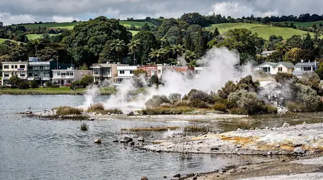
Because the caldera is still part of an active volcanic system, the region around Taupō keeps producing visible geothermal features: steaming ground, hot streams and boiling pools sit only a short drive from the lakefront, in the same way Rotorua’s suburbs sit next to Kuirau Park. It’s the same underlying process as the parks around Rotorua, just arranged around a very different-looking lake.
Lake Taupō: swimming, kayaking and cruising
The lakefront in Taupō town is the easiest part of the region to enjoy without booking anything: a walkable shoreline, lake views toward the mountains, and — in summer — water warm enough on the surface for swimming near the town beaches. Beyond the shoreline, the lake supports kayaking, sailing, paddleboarding and boat cruises, and it’s also one of the country’s known trout fisheries; see trout fishing around Rotorua and Taupō if that’s of interest, keeping in mind that trout is never sold commercially anywhere in New Zealand — restaurants can only serve what a guest has caught themselves.
For a first look at the lake beyond the shore, a lakefront cruise out toward Mine Bay covers the most photographed stretch of water without requiring any paddling experience.
a lakefront cruise from Taupō out to the Mine Bay rock carvingsThe Mine Bay Māori rock carvings
The single most distinctive sight on the lake is a set of Māori rock carvings at Mine Bay, cut directly into a cliff face that rises about ten metres out of the water. They were carved in the late 1970s and are accessible only from the water — there’s no path down to them by land, so a boat, kayak or paddleboard is the only way to see them up close. The carvings depict an ancestral figure and smaller supporting figures, and they sit low enough on the cliff that a cruise or a kayak can pull in close.
Kayaking gives a slower, quieter approach than a motorised cruise, and it’s a manageable half-day activity even without prior kayaking experience, since the crossing to the carvings from the nearest launch point is short and sheltered.
a guided kayak tour out to the carvingsFor background on the carvings themselves — who commissioned them and what the figures represent — see Māori rock carvings, Lake Taupō.
Huka Falls: the Waikato forced narrow
A few minutes north of Taupō town, the Waikato River — New Zealand’s longest river, which drains out of the lake here and eventually reaches the Tasman Sea near Auckland — is squeezed from a wide, calm channel into a gorge only about 15 metres across. The result is Huka Falls: not a tall drop, but an enormous volume of water forced through a narrow gap at speed, visible from a footbridge and several viewing platforms without any entry fee. It’s one of the few sights in the region that costs nothing and takes only a short stop to see properly.
Huka Falls also anchors several tours and jet-boat trips that combine the falls with other stops along the river; see Huka Falls and the Taupō jet boats for how those trips are usually structured. For a different vantage point entirely, a helicopter flight over the falls and the surrounding volcanic plateau shows the scale of the gorge — and the wider caldera — from above.
a helicopter flight over Huka Falls and the volcanic plateauCraters of the Moon
Just outside Taupō town, Craters of the Moon is a geothermal walking area of steaming vents, cracked ground and small craters, laid out on boardwalks that keep visitors on safe, marked paths. It’s less colourful than Wai-O-Tapu back near Rotorua and has no boiling mud pools of Hell’s Gate’s intensity, but it’s a straightforward, low-key way to see the same underlying geothermal system that produces the more dramatic parks further north — useful if a Taupō day trip already includes the lake and Huka Falls and there’s time for one more short stop before heading back.
South of Taupō: Tūrangi and Tongariro National Park
The lake’s southern end leads toward Tūrangi, a smaller town that serves as the usual base for the Tongariro Alpine Crossing — a 19.4-kilometre one-way walk across volcanic terrain, usually taking six to eight hours, past the cones of Ngauruhoe and close to Ruapehu, which rises to 2,797 metres and carries a ski field in winter. Tongariro was New Zealand’s first national park and is one of the few places in the world with UNESCO World Heritage status for both natural and cultural values.
The Crossing is a full day on its own and needs to be planned as a distinct trip rather than an add-on to a Taupō afternoon — see Tongariro Alpine Crossing from Rotorua for transport and timing, since most people doing it from Rotorua or Taupō use a shuttle rather than a self-drive loop. As with any alpine track in New Zealand, conditions and track status change with weather, so check with the Department of Conservation or a shuttle operator before committing to a date rather than assuming the track is open.
Thermal pools around Taupō
Taupō has its own natural thermal pools distinct from Rotorua’s — smaller and less commercialised than the Rotorua spas, often set beside a stream where hot and cold water mix. Several of these are developed into simple, adults-focused bathing spots rather than large resort-style complexes.
a day pass to Taupō’s natural thermal springsIf comparing options across the wider region, the Rotorua hot pools guide covers the larger spa complexes closer to Rotorua itself, while Taupō’s springs tend to be smaller and more low-key.
Adventure activities: bungy and beyond
Taupō, not Rotorua, is where commercial bungy jumping is based in this part of the North Island — there’s no commercial bungy operation in Rotorua itself. Taupō’s cliffs above the Waikato River are used for bungy jumping and swing-style jumps, and the town is also a base for tandem skydiving, with jumps that give views over the lake and the volcanoes to the south on a clear day. See Taupō bungy and skydiving for how these compare in height, intensity and what to expect.
Combining Taupō with the rest of the region
Because Taupō sits roughly between Rotorua and Tongariro National Park, it works well as a stopping point rather than only an out-and-back trip. A one-way route from Rotorua through Taupō and on to Tongariro, or a loop that also takes in Orakei Korako, covers a wide slice of the Volcanic Plateau without much backtracking. A guided day trip is the simplest way to combine several of these stops in one outing without self-driving between geothermal parks and the lake.
a day tour linking Rotorua, a geothermal park and Huka Falls
Anyone weighing up a guided day versus renting a car and driving the SH5 corridor independently should also read guided tours vs. self-drive around Rotorua and, if driving, driving in New Zealand for visitors — New Zealand drives on the left, and rural highways like SH5 are mostly single-lane in each direction.
When to go and what it costs
New Zealand’s seasons run opposite to the Northern Hemisphere, so December to February is summer here and June to August is winter — see best time to visit Rotorua and the month-by-month weather guide for the seasonal detail that applies across this whole region, including Taupō. In short: summer brings warm days, long light and lake swimming; winter brings cooler air, quieter trails, and often the clearest views of Ngauruhoe and Ruapehu across the water. Rain is possible at any time of year, and the sun’s UV strength in summer is genuinely high rather than a minor caution.
Prices in New Zealand already include the 15% goods and services tax, so the number on a menu or a ticket is what gets paid, and tipping isn’t expected — see tipping and costs in New Zealand for more on how pricing works here. As a rough per-person daily guide across accommodation, food and activities: budget travellers can expect around NZD 150 a day, mid-range travellers around NZD 350, and a higher-comfort day closer to NZD 700 — these are broad bands, not fixed costs, since actual spending depends heavily on which activities are booked.
Visiting Taupō: frequently asked questions
Is Taupō worth visiting from Rotorua?
Yes. It’s about an hour away, centres on New Zealand’s largest lake inside a supervolcano’s crater, and adds a landscape — open water and distant mountains — that Rotorua itself doesn’t have. It works as a half-day stop, a full day, or a short base before continuing to Tongariro National Park.
How far is Taupō from Rotorua?
About an hour by road via State Highway 5, without stops. Most day trips take longer once time is added for Huka Falls, the lake, or a geothermal stop along the way.
Can you swim in Lake Taupō?
Yes, particularly at the town beaches in summer, when the surface water warms enough for swimming. The lake is deep and stays cold below the surface even in summer, so conditions can vary by location and season.
How do you see the Māori rock carvings at Mine Bay?
Only from the water. There’s no land access, so visitors reach them by lake cruise, kayak or paddleboard, launching from Taupō town.
Is Huka Falls free to visit?
Yes. Viewing platforms and a footbridge over the falls are open to the public at no charge; boat and jet-boat trips that approach the falls from the water are separate paid activities.
Can you do the Tongariro Alpine Crossing from Taupō as a day trip?
Yes, though it’s usually done via Tūrangi, which sits closer to the trailhead than Taupō town. It’s a long day — typically six to eight hours of walking plus shuttle transport at each end — so it needs to be planned as its own dedicated day rather than combined with other Taupō sightseeing.
Is Taupō an active volcano?
Lake Taupō occupies the caldera of a supervolcano within the same Taupō Volcanic Zone that produces Rotorua’s geysers and geothermal fields. The area remains geologically active, which is why steaming ground and hot springs still occur around the lake, even though the caldera itself is now filled with water rather than erupting.
What’s the best time of year to visit Taupō?
Any time of year works, since the region has no dry season and no true off-season. Summer (December–February) suits swimming and long days; winter (June–August) suits quieter trails and clearer mountain views across the lake.