New Zealand’s first national park
Tongariro National Park sits south of Lake Taupō, roughly two and a half hours from Rotorua by road, at the southern end of the same Taupō Volcanic Zone that produces Rotorua’s steam and mud pools. It was established in 1894 as the country’s first national park, and it carries a status few places on the planet share: it is a UNESCO World Heritage site twice over, recognised for both its natural values — three volcanic peaks and the surrounding landscape — and its cultural significance to Māori, centred on the mountains themselves. Most visitors come for a single day, to walk the Tongariro Alpine Crossing, but the park is also the reason New Zealand has national parks at all, and the reason is a Ngāti Tūwharetoa story, not a scenic one.
Three volcanoes, one active landscape
The park is built around three named peaks: Tongariro, Ngauruhoe, and Ruapehu, which at 2,797 metres is the tallest of the three and carries a ski field on its slopes in winter. Tongariro and Ngauruhoe are both part of the same volcanic complex the Alpine Crossing walks through, and Ngauruhoe’s near-symmetrical cone is one of the most recognisable shapes in the central North Island skyline. Ruapehu stands apart, further south, its summit crater holding a warm, acidic lake that has produced destructive volcanic mudflows (lahars) in the past. All three remain part of an active volcanic system: eruptions and unrest are monitored, tracks can close with little notice, and the Department of Conservation (DOC) is the authority to check before setting out, not a guidebook or a tour operator’s brochure.
This is the same volcanic plateau that runs north through Taupō and on to Rotorua — one continuous rift in the earth’s crust, not three separate attractions. Standing on the Alpine Crossing and looking north across Lake Taupō toward the steam plumes above Rotorua is a way of seeing that connection directly.
A double World Heritage listing
Tongariro was inscribed as a UNESCO World Heritage site in 1990 for its volcanic landscape, and again in 1993 for its Māori cultural and spiritual significance — one of the first properties in the world to be recognised under UNESCO’s cultural landscape category, where nature and human meaning are assessed as one thing rather than two. That second listing is not a footnote. It reflects that the mountains are not scenery here; they are ancestors, and the park’s origin story is about protecting that relationship rather than protecting a view.
What the mountains are to Ngāti Tūwharetoa
The land around Tongariro, Ngauruhoe, and Ruapehu is the heartland of Ngāti Tūwharetoa, the iwi (tribal group) of the Taupō region. In 1887, the paramount chief of Ngāti Tūwharetoa gifted the summits at the centre of the range to the Crown, specifically so they could never be sold, subdivided, or damaged by private ownership — an act that led directly to the creation of the national park. It was a deliberate act of protection rooted in Māori custom, not a donation of unwanted land: the peaks are considered tapu (sacred), and the gift was a way of keeping them intact for future generations under a form of guardianship the colonial government could recognise.
That history is worth carrying onto the track itself. Photographing the summit of Ngauruhoe up close, walking off-track near the peaks, or treating the crossing purely as a fitness challenge sits at odds with how the mountains are regarded by the people whose ancestral land this is. Respectful behaviour on the Alpine Crossing — staying on the formed track, packing out all rubbish, and not summiting Ngauruhoe — lines up with the same expectations covered by the wider Tiaki Promise asked of every visitor to New Zealand.
The Tongariro Alpine Crossing
The Alpine Crossing is a 19.4-kilometre, one-way walk, typically taking six to eight hours, and it is usually described as one of the best one-day walks in the world. It is not a stroll: the track climbs steeply from the Mangatepopo car park up through the South Crater and past the Red Crater, the highest point on the route, before descending past the Emerald Lakes and the Blue Lake toward the northern end of the track. Weather changes fast at altitude on an exposed volcanic plateau, and conditions that are mild at the trailhead can be freezing and windy at the Red Crater — proper layers, wind and waterproof gear, sturdy footwear, and enough food and water for a full day are not optional extras.
| Detail | Information |
|---|---|
| Distance | 19.4 km, one-way |
| Duration | 6–8 hours for most walkers |
| Direction | Point-to-point; a return shuttle or transport arrangement is required |
| Highest point | Red Crater |
| Season | Walkable year-round in settled conditions; winter requires alpine gear and experience, or a guide |
Because it is a one-way track, almost everyone arranges transport rather than driving themselves — a shuttle to the Mangatepopo end in the morning and a pick-up at the far end in the afternoon. Track and weather conditions, including closures, change with the seasons and with volcanic activity, so checking DOC’s current advice before travelling is worth doing regardless of how the forecast looks from Rotorua.
Getting there from Rotorua
Tongariro sits about two hours and twenty minutes from Rotorua by road, past Taupō and through Tūrangi, the small town closest to the park’s southern side. Most visitors either self-drive and book a Crossing shuttle locally, or join an organised day tour that includes transport from Rotorua. If you are driving yourself, see the notes on driving in New Zealand for visitors before setting out, since mountain roads and rapidly changing weather are a different proposition from driving around Rotorua itself. For the logistics of timing a Crossing day trip specifically from Rotorua — shuttle options, what time to leave, and what a return looks like — see the dedicated guide on the Tongariro Alpine Crossing from Rotorua.
Because of the distance and the length of the walk itself, a Tongariro day is a full day: an early start from Rotorua, the Crossing itself, and a late return. Many visitors instead build it into a wider loop through the volcanic plateau, staying a night in Taupō or Tūrangi before or after, which also leaves room for Huka Falls or Craters of the Moon near Taupō without adding a second long drive. The Rotorua–Taupō road trip itinerary is built around exactly that pattern, and general planning for day trips from Rotorua covers how Tongariro compares with closer options like the Taupō day trip.
If a full alpine hike does not fit the day, the wider Taupō volcanic plateau can still be covered without it. A tour such as a full-day trip combining Huka Falls, hot springs, and Hobbiton stays lower and shorter while still reaching the same volcanic country and taking in a very different part of the North Island’s landscape on the way back toward Rotorua.
When to go, and what the Crossing demands
New Zealand’s seasons run opposite to the Northern Hemisphere’s: summer is December to February, winter is June to August. Summer gives the most predictable weather window for the Alpine Crossing, longer daylight, and less chance of ice on the exposed sections near the Red Crater. Outside summer, the track can still be walked, but snow, ice, and short daylight hours mean many visitors either go with a guide equipped for winter alpine conditions or choose not to attempt it — Ruapehu’s ski season, by contrast, runs through winter on the other side of the same volcanic complex. Rain and wind can arrive without much warning at any time of year, which is worth planning for using the general notes on weather in the Rotorua region month by month and the wider view of when to visit, even though Tongariro sits at higher altitude and colder than Rotorua itself.
Fitness matters more here than on most walks near Rotorua. Six to eight hours with a steep climb and a long descent, at altitude, on uneven volcanic terrain, is a genuine full-day hike rather than a scenic walk, and the exposed middle section offers little shelter if weather turns. Guided options exist for those who want local knowledge of conditions, help with transport logistics, or simply company on a long day; independent walkers rely on DOC’s posted conditions and their own preparation.
Beyond the Crossing
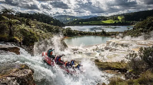
The Alpine Crossing gets most of the attention, but the Tongariro River below the park is one of the region’s rafting rivers, running through gorge sections rated for intermediate paddlers. A trip such as grade 3 whitewater rafting on the Tongariro River is a way to experience the same volcanic river system from the water rather than the ridgeline, and it needs far less time and fitness than the full Crossing, which makes it a workable add-on for a Taupō-area day that does not centre on the hike itself.
The park is also a useful point of contrast for Māori culture in the region more broadly. Ngāti Tūwharetoa’s guardianship of the mountains around Tongariro is a different story from Te Arawa’s living presence in Rotorua’s geothermal valleys, even though both sit on the same volcanic zone and both involve an active, ongoing relationship between an iwi and a landscape rather than a historical one. Spending a day at Te Puia in Rotorua, where Te Arawa culture and craft are demonstrated by the people who practise them, is a natural pairing with a Tongariro day for visitors who want to understand how differently — and how similarly — Māori communities relate to their local volcanic landscapes across the central North Island.
Practical notes
There is no fee to enter Tongariro National Park itself, though transport and any guided or shuttle services are booked and paid for separately, and precise current pricing is best checked directly with the operator rather than assumed. New Zealand’s biosecurity rules apply here as they do everywhere in the country: clean boots before and after the walk, and do not bring untreated soil, plants, or camping gear across from overseas without declaring it — see the wider notes on what not to bring into New Zealand if arriving from abroad. Visitors who need an NZeTA and the International Visitor Levy should have both sorted before travel, covered in the entry requirements guide.
Because Tongariro remains an active volcanic system, general guidance on the risks and etiquette of geothermal safety in the wider region is a reasonable starting point even though it was written with Rotorua’s parks in mind — the underlying principle is the same: stay on formed tracks, follow posted warnings, and treat sudden changes in ground, steam, or smell as a reason to turn back rather than investigate.
Tongariro National Park: frequently asked questions
How far is Tongariro National Park from Rotorua?
The Mangatepopo trailhead, where most Alpine Crossing walks begin, is about two hours and twenty minutes from Rotorua by road, via Taupō and Tūrangi.
How long does the Tongariro Alpine Crossing take?
Most walkers take six to eight hours to complete the full 19.4-kilometre, one-way track, not counting transport time to and from the trailheads.
Do I need a guide to walk the Alpine Crossing?
No permit or guide is required to walk independently in good conditions, though a shuttle or transport arrangement is essential since it is a one-way track. A guide is worth considering for winter conditions, uncertain weather, or for visitors who want local knowledge of the route and its history.
Can you climb Ngauruhoe or Ruapehu from the Crossing?
Side trips up Ngauruhoe exist informally but are steep, loose, and discouraged, and climbing the peak sits at odds with its significance to Ngāti Tūwharetoa, who regard the summit as tapu. Most walkers stay on the main formed track.
Is the Tongariro Alpine Crossing suitable for beginners?
It suits fit, reasonably experienced walkers rather than complete beginners. The distance, elevation gain, exposed alpine terrain, and changeable weather make it more demanding than most day walks around Rotorua.
Why is Tongariro a double World Heritage site?
It was listed by UNESCO first for its volcanic landscape in 1990, then again in 1993 for its Māori cultural and spiritual significance to Ngāti Tūwharetoa, making it one of the earliest places in the world recognised for both natural and cultural values together.
What is the best time of year to walk the Crossing?
Summer, from December to February, offers the most reliable weather and the longest daylight. Outside summer, snow and ice on the exposed sections mean the track demands alpine experience or a guide.
Can I visit Tongariro as a day trip and still see Taupō?
Yes, since Tongariro sits close to Taupō and Tūrangi on the same road south from Rotorua; many visitors combine both into a single overnight loop rather than two separate day trips.