A mountain that erupted within living memory
Mount Tarawera stands about 1,111 m high, roughly 20 minutes’ drive southeast of Rotorua past the shore of Lake Tarawera. For most of its history it was a quiet, forested dome. On the night of 10 June 1886 it tore open along a rift some 17 km long, and in a few hours it changed the geography, the tourism industry and the human history of this part of the North Island for good. It remains the only volcano in the region whose most violent moment is dated to the day, and it is still owned and managed by the people whose land it sits on, which is why visiting it today means going with a guide rather than driving up yourself.
This page covers what happened in 1886, why the mountain is closed to independent access, and the three realistic ways to see it now: a 4WD trip to the rim, a guided walk into the crater, or a scenic flight over the top.
What happened on 10 June 1886
Shortly after midnight, Mount Tarawera erupted along a line running roughly from the mountain itself down toward what is now Waimangu Volcanic Valley. Three craters opened along the rift in quick succession, throwing ash, mud, scoria and rock into the air. Ash fell as far as Tauranga and beyond. The eruption killed more than a hundred people, most of them in villages close to the mountain, and it buried the settlement of Te Wairoa under a layer of mud and ash that in places was several metres deep. Read the fuller account in the 1886 eruption story.
It also destroyed the Pink and White Terraces, a pair of silica staircases cascading into Lake Rotomahana that had drawn visitors from around the world since the 1870s and were, by most accounts, the country’s first true tourist attraction. Their loss is covered in detail in the story of the lost terraces; nothing that can be visited today replaces them, though surveys of the lake bed have found what may be fragments of the formation.
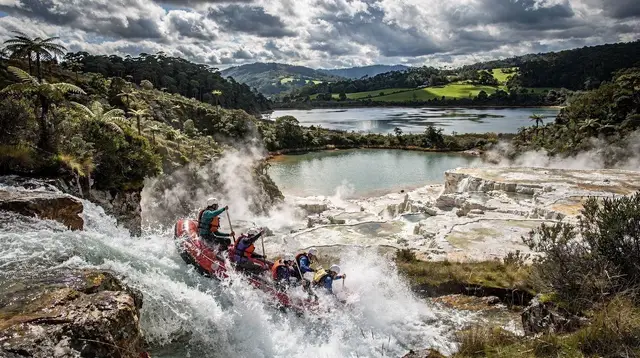
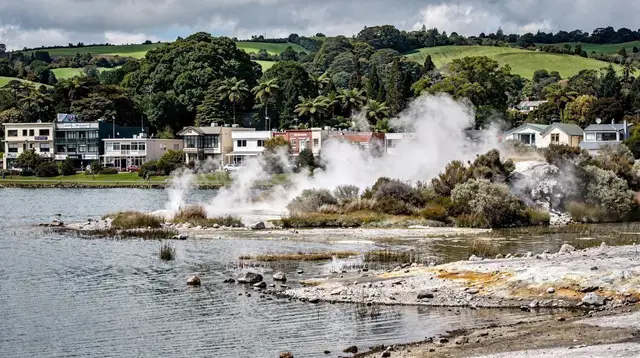
The eruption also permanently reshaped the landscape south of the mountain. Lake Rotomahana, previously a modest lake, expanded dramatically as the rift blew open beneath and around it. The valley that emerged from the rupture went on to become Waimangu — the only geothermal system on Earth whose birth date is known, because it did not exist as a thermal area before that night.
Why the mountain is guided access only
Mount Tarawera is privately owned Māori land, held by Ngāti Rangitihi, one of the Te Arawa confederation of iwi with deep ties to this whole volcanic landscape — background on that connection is in the history of Te Arawa in Rotorua. There is no public road, no unguided walking track and no legal way to reach the summit or crater on your own. Every operator running trips onto the mountain — on foot, by vehicle or by air over the crater — does so under an arrangement with the landowners, and that arrangement is also how the mountain’s cultural and physical significance is respected rather than treated as a backdrop.
This matters practically as much as ethically. Because there is no independent track, there is also no DOC hut, no marked trail and no rescue infrastructure built for casual hikers, unlike public conservation land elsewhere in the region. If a tour is cancelled for weather, there is no legal fallback route up the mountain that day. Trip planning and general precautions around this active volcanic zone are covered in the geothermal safety guide.
Three ways to see Mount Tarawera
Every legal option starts from Rotorua and falls into one of three categories: driving to the rim, walking into the crater, or flying over the top. They suit different levels of fitness, time and budget, and several operators run more than one option on the same day.
| Mode | Typical duration | Physical demand | Rough cost band (per person) |
|---|---|---|---|
| 4WD to the crater rim | Half day, including Rotorua transfers | Low — mostly seated, short walks at stops | Lower end of the mid-range travel budget |
| Guided walk into the crater | Half day | Moderate to high — uneven volcanic ground, some elevation change | Mid-range |
| Scenic helicopter or fixed-wing flight | Under an hour in the air, often sold with other stops | None — no walking required | Upper mid-range to high-end, depending on length and add-ons |
Costs vary by operator, season and how many other sites (Waimangu, Whakaari / White Island, Lake Rotomahana) are bundled into the same trip — check current pricing directly with the operator rather than assuming a fixed figure. As a rough anchor, a full day built around a mid-range Tarawera experience sits comfortably inside a typical New Zealand mid-range travel budget of a few hundred dollars per person for the day, and a scenic flight combined with other volcanic stops can push toward the high end of that range.
Driving to the rim
4WD tours use a formed access road up the flank of the mountain to a viewpoint near the rim, where guides explain the 1886 eruption and point out the rift line running down toward Waimangu. This is the least physically demanding option and suits visitors who want to understand the scale of the eruption and see into the crater without a long walk. Views on a clear day extend across the rift toward Lake Rotomahana and, in the other direction, back over Lake Rotorua and the city.
Walking into the crater
Guided crater walks take a smaller group on foot down into and across the crater floor, following a route the guide knows and the operator has permission to use. Expect loose volcanic scree, some steep sections and no shade — sun protection matters here as much as anywhere in the region, and the general seasonal notes in Rotorua’s free walking tracks guide on footwear and weather apply doubly on a volcano with no formed path. This is the option that gets closest to standing inside the actual 1886 rift rather than looking at it from a rim or a cabin window.
For a broader look at what a guided walk involves, when operators run it and how it compares with the 4WD option, see the dedicated Mount Tarawera walking guide.
an afternoon tour combining volcanic terrain with other geothermal stops around Rotorua is one way to see thermal country on foot without committing an entire day to the crater alone, for travellers weighing up how much of their itinerary to give to volcanic sights specifically.
Flying over the crater
Scenic flights — helicopter or fixed-wing — cover the most ground in the least time. From the air you see the full outline of the three 1886 craters, the colour contrast in the crater lakes, and often the wider rift running down to Waimangu and Lake Rotomahana in a single sweep, something no ground-level route can show. Some flights land briefly at the summit; others fly past without landing. Flight-based options are compared more broadly in the scenic flights guide.
a scenic flight covering Mount Tarawera and the Waimangu valley together is the most direct way to see both the mountain and the rift it created in one outing, useful if time is tight or the crater walk’s terrain is not appealing.
Because the 1886 rift runs in a straight line from Tarawera to Waimangu, several operators combine both in a single itinerary alongside a look at Whakaari / White Island further out in the Bay of Plenty — worth knowing that the White Island component today means a flyover or boat approach only, since landings there stopped after the 2019 eruption. a combined tour taking in White Island, Mount Tarawera and Waimangu Volcanic Valley in one day is built around exactly that geological line.
Pairing Tarawera with Lake Tarawera and Te Wairoa
Most visits to the mountain start or end near Lake Tarawera, which formed the approach route to the old Pink and White Terraces before 1886 and now sits at the foot of the volcano that destroyed them. The Buried Village of Te Wairoa, a short drive from the lake, preserves excavated remains of the settlement buried in the eruption and is the clearest on-the-ground way to understand what the disaster did to the communities living closest to the mountain, without needing to book a tour onto Tarawera itself.
Travellers with a full day can reasonably link a Tarawera experience with a stop at Waimangu Volcanic Valley, since it sits inside the same 1886 rift and its guided walking track requires no special land access. Wai-O-Tapu, further along the same road system, is a common third stop for travellers building a full geothermal-themed day; a two-day pacing for that kind of itinerary is laid out in the two-day geothermal itinerary. The nearby Blue and Green Lakes, Tikitapu and Rotokākahi, sit on the road toward the mountain too — Rotokākahi is tapu and closed to public access, a distinction worth knowing before assuming every lake here is open for a stop.
Practicalities: cost, timing and what to bring
Because access runs entirely through licensed operators, there is no admission fee to “the mountain” in the way there is for a park like Wai-O-Tapu — the cost is the tour itself, and it varies with mode, duration and what else is bundled in. Weather is the main variable affecting whether a trip runs at all: low cloud can ground helicopter flights and reduce crater-walk visibility to little, and heavy rain can make the access road or crater floor unsafe for a scheduled group. Operators typically confirm or reschedule on the morning of departure rather than days in advance, so booking a trip for early in a longer stay in Rotorua — rather than on the last available day — leaves room for a weather-related reschedule. General trip-planning notes for the region, including how many days to allow overall, are in how many days to spend in Rotorua.
Whichever mode you choose, bring sturdy closed shoes (essential for the crater walk, sensible even for the 4WD stops), sun protection regardless of season — New Zealand’s summer UV is genuinely severe, and there is no shade on the mountain — and a layer for wind, since exposed ridgelines and open helicopter doors are both colder than the valley floor below. There is no food or water available on the mountain itself; operators typically brief guests on what to bring beforehand.
Mount Tarawera in the wider volcanic picture
Mount Tarawera sits inside the Taupō Volcanic Zone, the roughly 250 km stretch of active geology running from Whakaari / White Island in the Bay of Plenty down to Ruapehu in Tongariro National Park. Within that zone it is unusual for having a precisely dated eruption within recorded New Zealand history, rather than a history reconstructed purely from geological layers. That single dated event — 10 June 1886 — is also why the region’s other headline geothermal features exist in their current form: Waimangu did not exist before that night, and the general explanation of why this whole area behaves the way it does is covered in why Rotorua is geothermal.
For visitors piecing together a itinerary, Tarawera works well as either a stand-alone half-day activity or as the geological anchor for a day that also covers Waimangu, Te Wairoa and Lake Tarawera — sites that only make full sense once the 1886 eruption that connects them is understood. Few single features in the region tie together the area’s volcanic risk, its cultural ownership and its tourism history as directly as the mountain that opened on one night in 1886 and is still, more than a century later, entered only by permission.